What Greyhound’s BusTracker Shows About GPS Tracking for Passenger Transportation
For years, Greyhound’s classic slogan urged travelers to “Leave the driving to us.” Today, passenger transportation companies are expected to do more than move people from one stop to another. Riders want visibility, accurate arrival information, and fewer surprises along the way.
GPS tracking has helped make that possible. By connecting vehicle location data with customer-facing tools, transportation providers can give riders, families, dispatchers, and operations teams a clearer view of where buses are and when they are expected to arrive.
BusTracker and Greyhound GPS Tracking
Greyhound’s BusTracker is an example of how GPS tracking can improve the passenger experience. The tool allows travelers to check the status of a bus using information such as a schedule number, departure city, or arrival city.
Instead of relying only on printed schedules, phone calls, or station updates, passengers can use a connected device to review bus status and estimated arrival information. Friends and family can also use that visibility to plan pickups more easily.
Real-time updates for travelers and families
For riders, the value is simple: better information reduces uncertainty. If a bus is delayed by traffic, weather, construction, or additional stops, GPS-powered tracking can help passengers see updated status information instead of waiting without context.
How Passengers Track a Bus
Passenger-facing tracking tools typically use GPS location data from vehicles and display that information through a website, mobile app, or customer portal. Depending on the system, riders may be able to search by route, stop, schedule number, departure location, or destination.
These tools can help answer common traveler questions:
- Where is my bus?
- Is the bus running on time?
- When should I arrive at the pickup location?
- When should someone meet me at the destination?
- Has the bus been delayed by traffic or route conditions?
For transportation providers, this type of visibility can reduce customer service calls, improve communication, and create a more modern rider experience.
Why GPS Tracking Matters for Passenger Transportation
Bus transportation can be difficult to predict. Traffic congestion, weather, road closures, passenger boarding, maintenance issues, and multi-stop routes can all affect arrival times.
GPS tracking helps transportation teams monitor vehicle movement and provide more accurate updates when conditions change. This can support both customer communication and internal operations.
For passenger transportation fleets, GPS tracking can help with:
- Route visibility.
- Estimated arrival information.
- Dispatch coordination.
- Delay monitoring.
- Vehicle location history.
- Customer service updates.
- Operational review after a route is complete.
Passenger Amenities and Fleet Visibility Work Together
Passenger transportation companies often compete on comfort, reliability, convenience, and service experience. Amenities such as Wi-Fi, power outlets, updated seating, mobile ticketing, and customer-facing route tools can help make bus travel feel more modern and predictable.
GPS tracking supports that experience by giving riders more confidence about the trip. Even when a delay occurs, knowing what is happening can improve the customer experience compared with waiting without information.
Fleet Management Lessons From Public Transportation
The same GPS visibility that helps passengers track buses can also help other organizations manage vehicles and mobile assets. Public transportation, school transportation, field service, construction, utilities, delivery, and public sector fleets all rely on accurate location data to keep operations moving.
Fleet managers can use GPS tracking to understand where vehicles are, how routes are progressing, when vehicles arrive at key locations, and whether delays are affecting service. This can support better dispatching, customer communication, maintenance planning, and operational accountability.
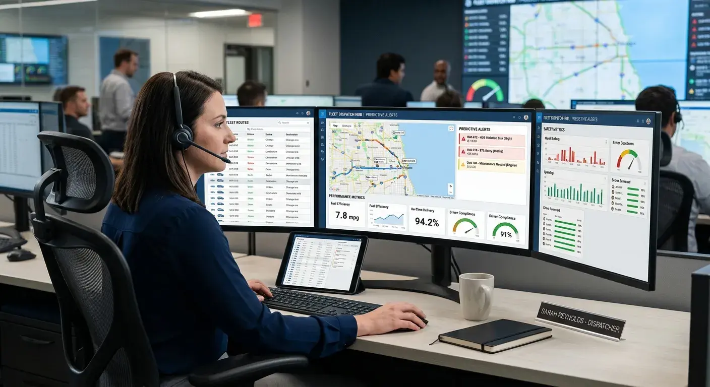
How GPS Tracking Helps Operations Teams
Behind every customer-facing tracking tool is an operational need. Dispatchers and managers need to coordinate vehicles, answer questions, and respond when routes do not go as planned.
GPS tracking can help operations teams:
- Identify vehicle location in near real time.
- Review route progress throughout the day.
- Support more accurate ETAs.
- Understand where delays occurred.
- Confirm arrivals and departures.
- Coordinate drivers, vehicles, and service teams.
- Review route history for planning and improvement.
This information can help teams move from reactive communication to more proactive fleet management.
Better Visibility Builds Trust
Whether a fleet carries passengers, delivers packages, services customers, or moves equipment, visibility matters. People want to know when help, service, or transportation will arrive.
GPS tracking helps businesses and public agencies provide clearer answers. When managers can see where vehicles are and how routes are progressing, they can communicate more confidently with customers, riders, dispatchers, and internal teams.
How Zonar Can Help
Zonar helps transportation, public sector, service, and commercial fleets bring vehicle, driver, asset, and operational data into clearer view. With fleet management, GPS tracking, reporting, alerts, geofencing, maintenance tools, and connected fleet visibility, Zonar can help organizations monitor vehicles, support dispatching, and make more informed decisions across daily operations.
To learn how Zonar can support your fleet visibility and passenger transportation operations, contact the Zonar team.