How GPS Has Modernized Agriculture
Modern agriculture depends on precision, efficiency, and visibility. Farmers and agricultural operators use GPS, sensors, mapping tools, connected equipment, and data platforms to make better decisions about planting, harvesting, irrigation, inputs, equipment use, and field operations.
GPS technology has become especially important because it helps agricultural teams understand exactly where equipment, assets, and field activity are located. When combined with other systems, GPS can support more accurate work, reduce waste, improve planning, and help teams make better use of land, labor, and equipment.
How GPS Supports Modern Agriculture
GPS uses satellite signals to help determine location. While the technology is widely used for navigation, transportation, logistics, and consumer mapping, its role in agriculture is more specific. On farms, GPS can help operators work within fields, sections of fields, routes, and equipment paths with much greater precision.
This has helped support the growth of precision agriculture. Instead of treating every acre the same way, farmers can use location-based data to understand differences within a field and adjust operations accordingly.
Why location accuracy matters
In agriculture, small differences in location can matter. GPS can help equipment follow more consistent paths, reduce overlap, improve field coverage, and support better documentation of where specific work has been completed.
GPS and Farm Equipment Guidance
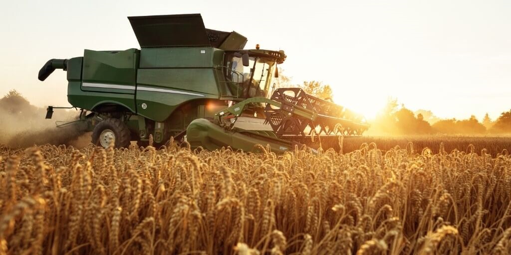
One of the most visible uses of GPS in agriculture is equipment guidance. Tractors, sprayers, harvesters, and other machines can use GPS to follow more accurate paths through a field.
That precision can help reduce missed areas and unnecessary overlap. For example, a farmer may use GPS-guided equipment to till, plant, fertilize, spray, or harvest along consistent field paths. This can help save time, reduce input waste, and improve the consistency of fieldwork.
Some equipment systems may also support automated steering or assisted guidance. These tools can help operators maintain straighter rows, reduce fatigue, and improve repeatability during long workdays.
Turning Fields Into Data
GPS becomes even more valuable when combined with geographic information systems, or GIS. GIS tools allow agricultural teams to connect data to precise locations in a field.
That data may include soil conditions, elevation, drainage, crop health, yield history, moisture levels, pest pressure, or equipment activity. When mapped together, these layers can help farmers understand how different parts of a field are performing.
Farmers and agricultural teams may collect this information from field equipment, sensors, drones, aircraft, satellite imagery, and manual observations. When combined with GPS, this data can support more targeted decision-making.
Reducing Waste With Precision Agriculture
Precision agriculture can help reduce waste by applying resources where they are needed most. Instead of treating a field as one uniform area, farmers can use location-based data to make more specific decisions.
For example, irrigation may be adjusted based on soil moisture and field conditions. Fertilizer may be applied more precisely where nutrient levels are low. Pesticides may be targeted to areas where pest pressure is identified. Equipment routes may be planned to reduce unnecessary passes through the field.
Actual results vary by operation, crop, equipment, climate, and how the technology is used. But the overall goal is clear: use better information to reduce unnecessary inputs and improve operational efficiency.
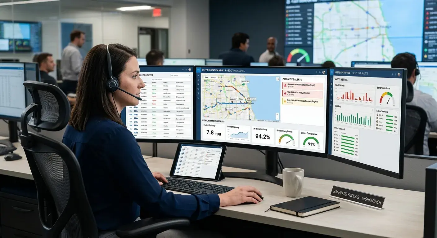
Improving Equipment and Asset Visibility
Agricultural operations often depend on valuable equipment spread across large areas. Tractors, trailers, irrigation equipment, implements, service vehicles, and other assets may move between fields, yards, storage areas, and job sites.
GPS tracking can help teams see where equipment is located, when it moves, and how it is being used. This visibility can reduce time spent searching for assets, support maintenance planning, and help managers understand utilization across the operation.
For larger agricultural businesses, cooperatives, and service providers, equipment visibility can also support dispatching, seasonal planning, job verification, and accountability across teams.
Planning for the Future of Agricultural Technology
Precision agriculture continues to evolve as GPS, sensors, automation, analytics, and connected equipment become more accessible. For many agricultural operations, the challenge is not whether technology can help, but which tools are worth the investment.
Before adopting new systems, teams should review their operational goals, equipment mix, field conditions, connectivity, staffing, training needs, and expected return. A technology that works well for one operation may not be the right fit for another.
The best approach is practical: identify the problem, choose tools that solve it, and make sure the data supports real decisions in the field.
How Zonar Can Help
Zonar helps organizations bring vehicle, asset, equipment, and operational data into clearer view. For agricultural and field-based operations, GPS tracking and fleet management tools can help teams improve visibility into equipment location, vehicle activity, utilization, maintenance, and daily operations.
To learn how Zonar can support your equipment tracking and fleet visibility goals, contact the Zonar team.